Full waveform inversion
Full-waveform-inversion
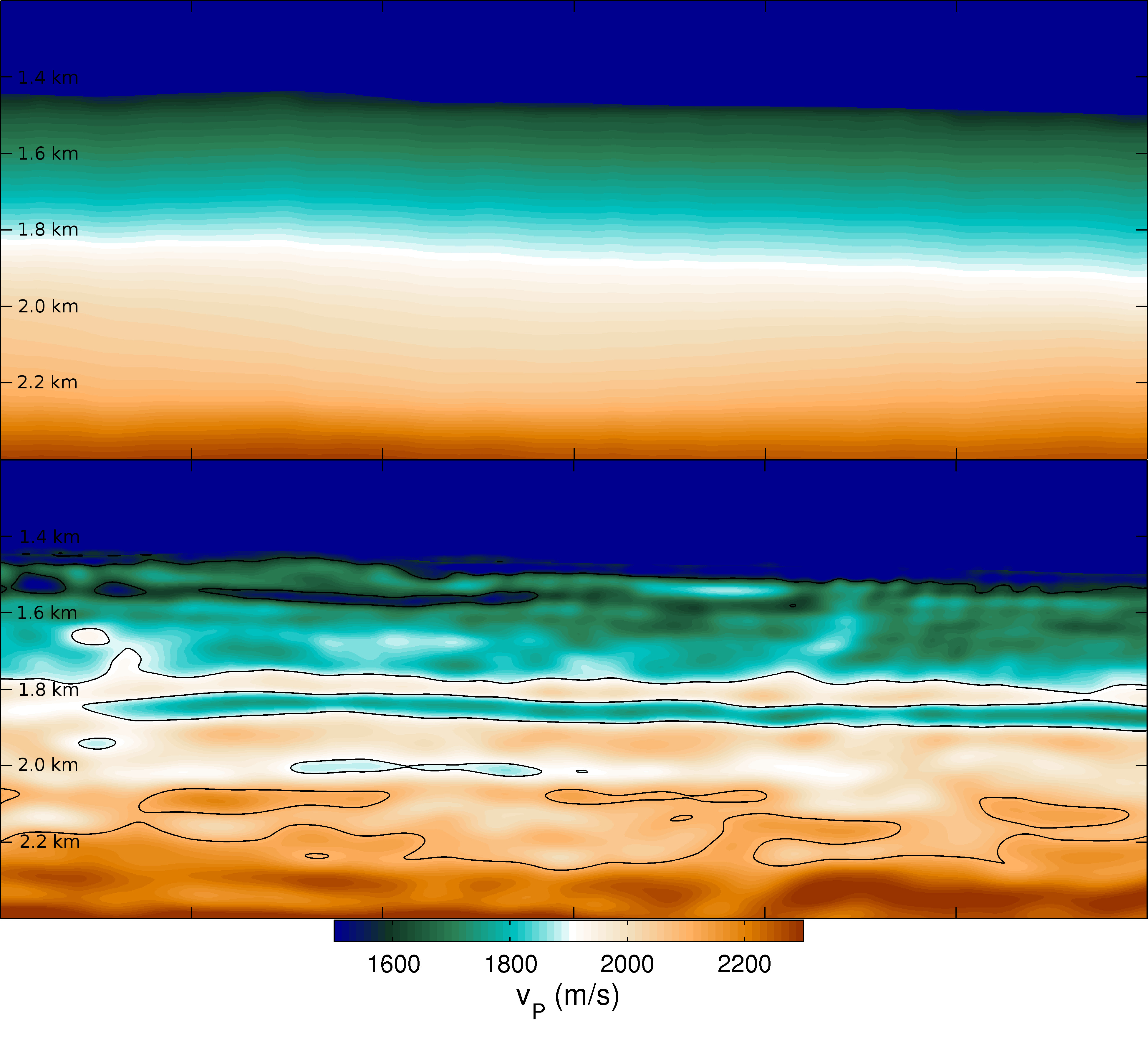
Full-waveform-inversion (FWI) is a state-of-the-art tool for high-resolution subsurface velocity model building. Starting out from the wavefront tomographic models we use acoustic, elastic and visco-elastic forward modeling and inversion with an emphasis on high-performance computing aspects.
We handle projects from small-scale near-surface applications (geotechnical field) in the meter range using surface waves up to exploration-scale involving depths of several kilometers. The ultimate goal thereby is the determination of elastic, anisotropic properties of the Earth including attentuation. We develop in-house software in cooperation with our partner Fraunhofer Institute that runs seamlessly on CPU as well as GPU hardware. Sophisticated integration tests are rune on field data from partners/sponsors as well as near-surface data we acquire ourselves.